Last week I attended ForestTech 2023, Asia Pacific’s premier forestry conference. The annual event spans both sides of the Tasman, taking place in Rotorua and Melbourne. I was fortunate enough to traverse the ditch and participate in this significant gathering held in the cultural capital of Victoria.
Joined by Ruby Donaldson, the Director of Locus Australia, we set up our stand in the exhibition room of the Jasper Hotel, just round the corner from Queen Victoria Markets. To the uninitiated a Forestry conference might not be the first place you would expect FME to make an appearance, but you would be surprised at how technology focused most forestry companies have become.
Amidst the enduring popularity of chainsaws and plaid flannel shirts, the presence of mouse-wielding GIS technicians has become just as crucial, if not more so, for successful forestry companies aiming to maximise the yield of a product that takes over 60 years to mature.
The conference unfolded over two days the first day primarily dedicated to exploring the use of information technology, much of it inherently spatial, for forest management. Remote sensing, employing satellite, aerial, or drone imagery, along with LiDAR technology, has become commonplace. With its prevalence comes the data challenge of managing and, more importantly, automating the production of data products that narrate the story of the forest.
Ruby and I watched several presentations which demonstrated how AI is being used to analyse remote sensing data to identify the height, diameter, crown and condition of individual trees.
Over the years the forestry industry has seen an improvement in the resolution of analysis resulting in a shift from managing the forest, to managing stands, to managing patches to managing individual trees.
This wealth of information helps Forest Managers and Forest Harvesters understand when to plant, when to thin, when to treat and when to harvest the forest for maximum yield.
During breaks, Ruby and I engaged with delegates, many of whom hailed from the technical side of the forest business, seeking opportunities to enhance their offerings to clients. After a demonstration of FME to a GIS analyst, she exclaimed in wonder and disbelief, “You can automate everything I do manually!”
This revelation encapsulates the essence of FME—not merely data conversion but a powerful tool for automation.
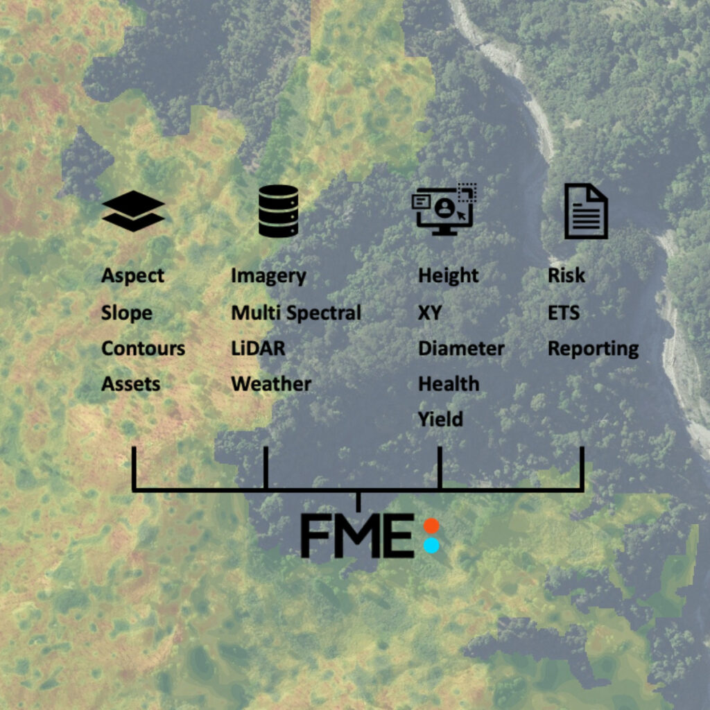
Traditionally, forestry has been a resource intensive-industry, but now like so many other sectors it is a data hungry business. It has become clear that FME with its capacity to manipulate and automate data and processes is simply the next step in the evolution of forestry management.
We anticipate witnessing the continued growth of FME in the forestry industry across New Zealand and Australia. The challenges on either side of the Tasman may vary, but the demand for information products supporting the sector is on the rise. FME stands out as the only platform capable of working with and comprehending the complex nature of both spatial and non-spatial data.
If you’re interested in learning more about how Locus and FME support the forestry sector, feel free to reach out to Ruby in Australia or me if you’re in God’s Own.