What is FME?
The only all-data, any-AI platform
TRAINING
Hands-on, practical training for individuals and teams
INTEGRATION
Remove silos, connect all your data and make it usable
Overview
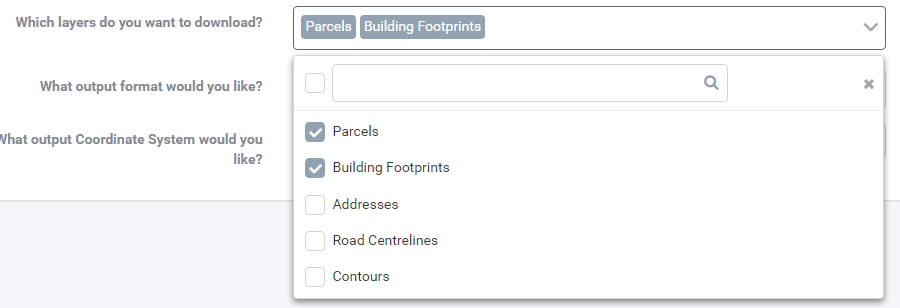
LINZ Data Service, the key holder of land information, is one of New Zealand’s most widely accessed data portals. Entities of all types retrieve data from LINZ, and keep it up to date on a regular basis. While the LDS (LINZ Data Service) has some great options for downloading data in different formats, the need to manually download the data and perform data transformations to it can create a large overhead for any organisation. For this reason, FME is a great solution to both automate the flow of data from LINZ, as well as perform transformation to it at the same time.
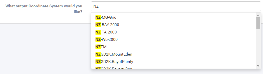
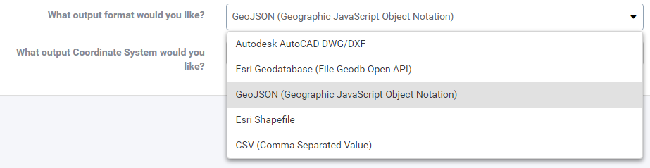
Transformations could include modifying data attribute names to match an internal schema, clipping data to an area of interest, or transforming it’s coordinate system to match your localised needs (just to name a few).
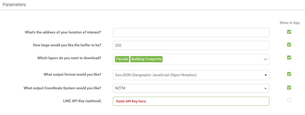
This example demonstrates the power of FME, using an FME Flow App to integrate with the LINZ Data Service. Behind the scenes, a workspace created using FME Workbench defines how we want this translation to work.
How it Works

The address which is found will be the centre point of your data extract, and can be buffered by a maximum of 500m.
Publish it Yourself
The files used to publish this FME Flow App can be downloaded here. You will need to complete the following steps to configure it to run with your own FME Flow installation.
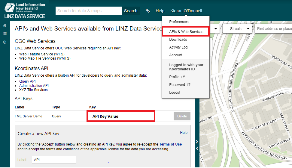
Once you click ok to save the details, the app will be enabled and provide you with a URL to access the server application.
Summary
FME Flow Apps are a great way to enable non-technical users a way to leverage the power of FME.
By doing so in a controlled environment, you can empower your users to utilise the technology without any worry of doing damage, or occupying too much time on your server engines.
This is just one example of a simple server app, but provides some great foundations for how you can build your own to get the most out of FME – and bring data closer to your customers.

