FME Form
Design intuitive workflows to convert, validate, and integrate your data. Simplify complex tasks, remove manual ones, save time, and improve data quality.
Design intuitive workflows to convert, validate, and integrate your data. Simplify complex tasks, remove manual ones, save time, and improve data quality.
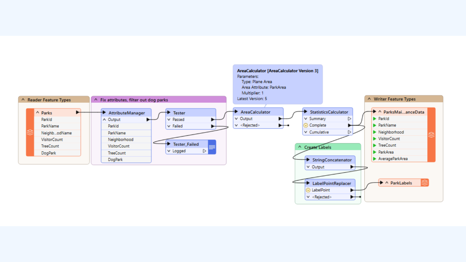
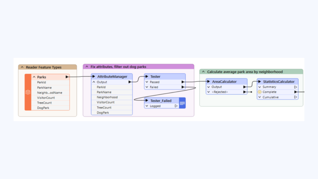
The industry leader in geospatial data integration, FME is a all-data, any-AI, no-code enterprise platform. Build workflows in a few quick clicks, support hundreds of data formats and integration between multiple applications. Use readers and writers to define how data enters/exits your workflow. Choose from hundreds of transformers to perform specific actions on your data i.e. filtering, formatting, or spatial calculations.
FME Form is your authoring environment and starting point for building powerful data solutions. With a simple installation, intuitive interface, the help of Locus, along with a global community of thousands of users, you’ll transform your data with ease.
Built complex data transformations with the all-data, no-code interface. Connect thousands of data types, regardless of source.
Move your data wherever it needs to go. From ETL to replication and synchronization, FME handles it all.
Direct support for all geospatial data formats, including Vector, Raster, 3D, Point Clouds, Data Cubes, and more.
Easily understand and inspect all of your data and gain insights on how it changes as you build your workflows.

Book a obligation free chat, product demo and receive a complimentary FME trial licence


Project based deliverables and deadlines often demand extra support. Talk to Locus about your short (or longer) term FME support needs

For 15+ years, Locus has been helping New Zealand and Australian businesses do more with their data. We are a Pae Hokohoko NZ Government Marketplace Approved Supplier of Data and Information Management, Data Management Training Services and Data Migration Services. With deep local experience across multiple industries, we have all you need to succeed with FME.
Professional guidance from data integration specialists with decades of experience working with businesses like yours. We’ll review existing data sets, handling and infrastructure and work with you to design and deploy the new, while ensuring it fits with your existing IT ecosystem. We’re with you every step of the way and can be on-site or remote as needed.
Contact Us
Helping organisations build their own internal capability is something we pride ourselves on. We want to share our knowledge and skill and have a range of training courses available for the absolute beginner through to advanced user and everything in-between. Choose from a range of standard or bespoke options.
More Training Info
Locus is your Premium FME Reseller and Value Added Safe Software Partner. We have a solution to fit every budget, chat to us about your data integrationneeds and we’ll work with you to define what meets your immediate needs, and scale for future growth.
Contact Us
Locus Plus+ is everything you need to succeed with FME. Need a project delivered fast or a helping hand with weekly tasks – our data professionals can help boost your organisation’s productivity now and well into the future, helping you build internal capability and maximise your investment in your people and the FME platform.
Locus Plus+ Pricing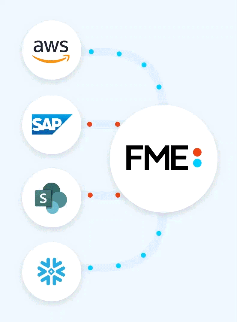
View our useful FME considerations flow chart to discover which product and licencing plan is right for you and your organisation
Learn More
It’s the business and technical support you need to succeed with FME. Chat to the experts
Learn More